Thursday, December 12, 2019

Postscript to the U.S.-Dakota War

by Curt Brown [Minneapolis Star Tribune, November 8, 2015]

Shakopee, left, and Medicine Bottle were hanged three years
after the U.S.-Dakota War because military leaders wanted to
prove they finished the job.     
[Source:  Minnesota Historical Society]
They were the last two high-profile holdouts.

The bloody U.S.-Dakota War had been over for three years. Thirty-eight Dakota men had been hanged in Mankato. But white military and political leaders weren’t satisfied.

They felt they had to show, once and for all, that they’d handled the Indian problem and the frontier was back in business for immigrant settlers who could replenish the fledgling Minnesota economy.

So just after noon on Nov. 11, 1865, 425 soldiers marched in formation to surround a specially constructed double gallows at Fort Snelling.

More than 400 St. Paul citizens turned out 150 years ago to watch the hangings of two Dakota leaders: Medicine Bottle and Shakopee. They had eluded soldiers for years, escaping across the Canadian border to Manitoba with more than 500 Dakota refugees from the war.
John McKenzie was the man who drugged Little Six (aka Shakopee) and Medicine Bottle after the Sioux massacre and brought them in this condition from Manitoba and delivered them to Major E. A. C. Hatch. Knowing the frailty of Little Six, who was a different man from the old chief Little Six, his father, McKenzie left a bottle of drugged whisky with a woman at the house which he was accustomed to visit, knowing that his greedy appetite would ferret it out. The artifice succeeded, and Little Six and Medicine Bottle were tried and hung at Fort Snelling for killing Philander Prescott. - History Of The Minnesota Valley, Scott County History Archives, 1882
Their flight ended in January 1864, when Shakopee and Medicine Bottle stopped by the home of a white friend near Winnipeg’s Fort Garry. That "friend" - Canadian trader, John McKenzie - was secretly in cahoots with a U.S. Army major across the border in what would become Pembina, N.D.

McKenzie plied both Indian leaders with alcohol laced with drugs. Shakopee, then in his 50s, was dosed with chloroform and rendered unconscious. Medicine Bottle, in his mid-30s, struggled longer but several men subdued him. Both Dakota men were tied to dog sleds and taken to Pembina, then Fort Abercrombie, en route to Fort Snelling.

The Minnesota Legislature forked out $1,000 — big money in the 1860s — to McKenzie as a bounty. Trials were held and both men were convicted despite sketchy evidence that they had committed atrocities during the war. They were blamed in the death of Philander Prescott, 60, who had lived among the Dakota for more than 40 years. He was beheaded on the first day of the war as he fled toward Fort Ridgely.

“It would have been more creditable if some tangible evidence of their guilt had been obtained,” said an editorial in the St. Paul Pioneer Press, published the day before the hangings.

The newspaper said “no serious injustice will be done by the execution,” but warned of a dangerous precedent of “hanging without proving.” Saying the men were probably guilty of murder, the paper nevertheless pointed out that “no white man, tried by a jury of his peers, would be executed upon the testimony thus produced.”

President Abraham Lincoln had been assassinated seven months earlier. He had stepped in to reduce the number of Dakota men hanged in Mankato from 303 to 38.

One of Medicine Bottle’s descendants, Dakota researcher and filmmaker Sheldon Wolfchild, insists Lincoln would have halted the hangings. But the president’s successor, Andrew Johnson, quickly approved the executions of Medicine Bottle and Shakopee.

When Shakopee and Medicine Bottle were captured in Manitoba, a French Jesuit priest and missionary named Augustin Ravoux baptized them and administered their Last Rites, accompanying them up until their final moments on November 11, 1865.


Wolfchild, 68, lives in Morton, Minn., and has produced a film about the era that saw his ancestors swept from the area five generations ago.

After their hangings, some of the witnesses ran up and cut off pieces of the nooses for souvenirs. St. Paul photographer Joel Whitney snapped glass-plate images showing white caskets at the feet of the dangling men.

Wolfchild says rocks went in the caskets that were buried in a nearby cemetery, with onlookers thinking they had witnessed the interments of important Dakota figures.

Their bodies, instead, were taken away in a horse-drawn cart at the behest of two doctors with offices near 7th and Jackson Streets in St. Paul. Some accounts say the doctors dug up the bodies the next day.

Wolfchild says Shakopee’s body was preserved in a wooden whiskey barrel and sent to a Philadelphia medical school where a professor Pancoast used it in anatomy lessons. St. Paul doctors dissected Medicine Bottle’s body.

“Who is the savage here?” Wolfchild asks. “Running to the scaffold to get a piece of the rope? The bottom line is they had to dehumanize us to where we were little more than beasts so they could get rid of us.”

Wolfchild says that his grandfather five generations ago, Medicine Bottle, didn’t die instantly when his body dropped at the Fort Snelling gallows.

While Shakopee’s neck snapped immediately, he said, Medicine Bottle dangled for 10 minutes before dying.

“He was saying: ‘We don’t die like that. You cannot kill us with a rope,’ ” Wolfchild said. He’s trying to find any remains that might still exist of the two men, pointing to the Missing In Action banners popular since soldiers went missing in the Vietnam War.

“We feel the same way about our ancestors, they are missing in action and their bodies are in universities, museums and private homes,” he said, “waiting for proper burials so they can continue their journey to the spirit world.”

Scaffold:  Shakopee and Medicine Bottle, moments after the execution
[Photographer:  Joel Emmons Whitney - Source:  Minnesota Historical Society]

Thursday, November 28, 2019

Water Cooler V: Aunt Mildred's "Books"

In this edition of the "Water Cooler":  A wonderful visit among old friends and neighbors brings up some interesting recollections and memories - plus a tantalizing clue about Aunt Mildred's "books" that could provide a treasure trove of local Humboldt history!  Read on...
Darlene Liedle Daugherty What are you doing up? 
Cleo Bee Jones Same ol' same ol'...it gets old, doesn't it?  
John Nelson Home on the prairie. Homesick! 
Geo Howry Did you attend classes in the Elevator or the grain storage buildings? 
Cleo Bee Jones Actually, George it was in Selmer Locken's restaurant! I studied Buddy Holly's music... 
Bernie Marek I think my dad went to school there. 
Cleo Bee Jones Bernie, what is your Dad's name ? 
Keith Finney George, I later studied at the elevator with Punky. 
Bob Bockwitz Selmer's restaurant goes back a couple years... 
Michael Rustad Selmer - Selmer and Sandra Locken. The old bank building made a pretty good restaurant. I wonder why they tore it down as it was a brick building. And when was Selmer's restaurant torn down? Who remembers the It Cafe? Dotty Boatz had an amusing story about Bob going for lunch there until he discovered one of the kids pounding out hamburger patties with their feet! I remember that the Voits ran the It cafe and conceived of it as a dinner supper club with music. It missed the mark. I wonder what years that Ward and Ruby Finney had the restaurant. The Voits had it in the mid-sixties. Does anyone know what year Mayme's Fairview Grocery Store closed? The building stood for a decade of so after the closing. 
Cleo Bee Jones Keith, we are waiting for you to tell us... 
Bob Bockwitz Yes, Keith, we're waiting... 
Harry, when he worked for the Great Northern 
Bob Bockwitz The years back then all seem to turn to mush in my head, but I would say that the It Café would have been open through '63 and '64. Run by Kenny and Jean Voit. Kenny helped my dad for a short period of time. My dad and Harold Borg would take the football team there for hamburgers. Ward and Ruby would have been in there about '60-'61. Years may be a little off, but would be pretty close, based on 1964, when I graduated. Ruby had a pin-ball machine with a corner broken out of the glass. On the wall next to the machine hung a 'tool' made out of a coat hanger. The tool was bent just right to reach through the hole in the glass to give yourself a couple of games to start with. Ruby (bless her heart) thought it was cute, and never took away the 'tool'. I remember, too, Warren Reese. Warren had lost his legs and as we went to school in the morning, we would pick him up and carry him into the café. These conversations trigger a lot of memories. 
Bob Bockwitz I think Mayme would have closed at the very tail end of the sixties...? 
Cleo Bee Jones I recall Warren Reese when he had the little tiny restaurant in Pembina, the best malts ever, way before your time...! It was across from the Immigration bldg. Just a tiny little hole in the wall ! I wonder what happened to her [Aunt Mildred] "books", journals, as with Viola gone, too. 
Bob Bockwitz You got me there. I wasn't even aware he had a café. All I really remember of him is carrying him in and out of the café in Humboldt. I have a book that I acquired after Mom got killed. She had written almost everything about the family in it. Mostly family, though, and not so much about the community at large. I'll have to dig it out again and read through it to see what tidbits I can find. I know Ruby is mentioned because they were such close friends. 
Cleo Bee Jones I am trying to recall if he was son of Sid and Hattie Reese? Was Lorraine his sister...my story about her, I was singing at the Golden Nugget in Vegas and got a note that said, Do a song for the gal from across the "big ditch"...it was from her, as she and her husband had known I was there and come over to Vegas from LA (I think it was) to see me. I loved it. She was friends with Virginia and the family and I thought she was beautiful... 
Bob Bockwitz I think you're right. For some reason I don't recall Lorraine, though. Rodney is at the lake, so I can't ask him. I really need to get him talking some time and take notes. 
Cleo Bee Jones It was always sort of a joke, about Aunt Mildred's "books" as she must have stayed awake 24 hrs a day, to know everybody's moves in Humboldt, but I thought the world of her, even until she was quite up in age, as she really liked my late hubby...I know I have talked about this before, but worth another stab at it...after an appearance at Hallock Fair she got right up on the stage to visit with him. I was just so surprised and loved it. Quite a gal!! 
Michael Rustad Thanks everyone. Now this is one of the really useful and brilliant forms of communication on Facebook. 
Bob Bockwitz I know. I can look in Mom's book and see what day in 1954 she got a new sewing machine, or the day I got my hand in the lawn mower. Unfortunately, she didn't write too much about out in the community, even though she loved the community so much. 
Keith Finney I think Mildred knew when the Pope Pooped. She wrote everything down. 
Trish Short Lewis This has turned into another Water Cooler post, Michael...!

Monday, November 18, 2019

Junction Drive Inn


These are photographs from the Larson Family Collection. Before there was an Interstate Drive-In (just west of the old KCND-TV building in Pembina), the Larson family started their drive-in business on the Minnesota side, at the (St. Vincent) Junction.

It was a much smaller affair, but much loved in its time. So much so, they had to build a larger one. It was right around the time that I-29 was being built, and the Larson family wisely thought it might be a great location for the new Drive-In. My older sisters Sharon and Betty Short were among the many young ladies who worked there in high school as waitresses...

Saturday, November 16, 2019

St. Vincent Murder Trial

Matters of jurisdiction happened quite often in our area, due to the fact that we are close to an international border, as well as two states side by side, separated only by a river.

As you'll read here, such was the situation in the case discussed below; the method used to resolve it was, shall we say...creative!

[NOTE:  Any new information is courtesy of Jim Benjaminson, Pembina County Historical Society]
_______________

George Bates Murdered While Intoxicated, at St. Vincent

Bismarck Weekly Tribune, March 24, 1899
Courtesy:  State Historical Society of ND and
the Library of Congress' Chronicling America
Wednesday morning (March 8, 1899) the news went mouth-to-mouth that George Bates had been found dead in his house. The details as they began to develop were highly sensational.

Mr. Bates was addicted to excessive drinking. When under the influence of liquor he was apt to quarrel with his family. On Wednesday afternoon he had trouble of this kind. Later, he went to St. Vincent. What happened there is still somewhat contradictory at this writing.

Wednesday morning Mrs. Geo. Bates came downstairs and found her husband lying on the floor with every evidence of having been severely pounded. She hastily summoned Register of Deeds Chisholm from the office nearby and upon examination it was found that Bates was dead. He had a hole in his skull near the right temple from the effects of a blow of some kind and his face was badly bruised and had been bleeding profusely. As nearly as the facts can be gotten at they are as follows: Last night at 11:30 two young men from St. Vincent, Minn., just across the river brought Bates home and deposited him on the floor. They then notified Marshal Moorhead, who went up to see Bates. He found him apparently sleeping off the effects of a booze and did not arouse the family. This morning as above stated he was found dead.

Bates’ collar and a piece of his shirt were missing and this morning they were found in front of a saloon in St. Vincent kept by John Smith. Smith denies any knowledge of the affair, except that several Pembina parties were in a row in front of his saloon last night, but he had a badly swollen right hand and fails to account for it. He has been placed under arrest to await the verdict of the coroner’s jury.

George H. Bates, the deceased, was a heavy set man, aged about 50 years. He leaves a wife and two grown daughters in this city and one son, who resides in Grand Forks, who are much respected by our citizens and have the sympathy of the community.

Mr. Bates was naturally a bright man and but for his unfortunate habits would have been a prominent man in the community. In past years he had occupied responsible positions and has been well off peculiarly. He was for some years a customs officer at St. Vincent.

John Smith, the saloon keeper, over whom hangs so dark a cloud, has an excellent family, consisting of a wife and three children, one of the latter being a young man of about twenty one years of age.

A further note – Later Smith was given a preliminary hearing and arraigned for manslaughter, to be tried at the next term of the criminal court at Hallock, Minn.

Reprinted from the Pioneer Express, in the St. Thomas Times - March 17, 1889, Vol. XVII No. 42


____________________

From the Neche Chronotype
April 1, 1899

The trial of John Smith, the St. Vincent saloon keeper, who is charged with having caused the death of George Bates at that place a short time since, and which was to have taken place this week, has been postponed owing to the serious illness of the defendant. It will be remembered that at the time of Smith’s arrest one of his hands was found to be badly lacerated, as a result of the row in which poor Bates received the injuries that cost him his life, so it is claimed, and blood poisoning having resulted, his recovery is thought to be extremely doubtful.

Tuesday, November 12, 2019

Ox Cart Trails: WOODS BRANCH

The oxcart trail on the open prairie. Photo courtesy Wadena County Historical Society 

History of the Woods Branch of the Red River Trails (1844-1870)
Written By: John Crandall, Special to Wadena Pioneer Journal | 

Commencing in Winnipeg, Manitoba, Canada the Red River Trail squirreled its way down the Red River Valley and down the Minnesota River Valley to Mendota and later St. Paul, Minn. Thus began a half century of commerce between the Selkirk colonies in Manitoba, Canada and St. Paul.

In 1812 Thomas Douglas, fifth Earl of Selkirk was granted thousands of square miles of land in Manitoba where the Assiniboine River and the Red River meet (Winnipeg) by the Hudson Bay Company (HBC), which had been founded in England in 1670. Portions of this land grant extended West and Southwest into what we know today as Minnesota and North Dakota. Selkirk dreamed of establishing an agricultural colony for Scottish settlers in the New World. But the Earle’s dreams would not continue peacefully. It only infuriated the Northwest Fur Company.
With the British traders entrenched in the region around Hudson Bay, the struggle for the soul of the interior of North America and the riches provided by the lucrative fur trade industry began.

The French traders and voyageurs began exploring the Great Lakes and west at the start of the 18th century, establishing many fur posts along the waterways that followed the future Canadian and American boundaries. With the signing of the Treaty of Paris in 1763 ending the French and Indian War (1754-1763) France gave up over a century of control of Canada to England.
With the French relinquishing their claim to Canada, exploration and trade began to expand into the interior of America. First, in 1784 came the reorganization of the Northwest Fur Company (NWC), which sought to challenge the monopoly the Hudson Bay Company had on the fur trade industry. Between 1783 and 1821, there was an immense increase in the amount of bloodshed and open hostility between the HBC and NWC ending only after the two companies merged in 1821. Secondly, came President Thomas Jefferson’s Louisiana Purchase in 1803.

Even after the end of the American Revolution, the northern boundary of the newly formed American States was unclear. The British continued their incursions into the Red River Valley. It wasn’t until after the War of 1812 that America put a total end to the British occupancy of the United States. In order to stop British traders from enticing the Native Americans to continue trading with them, Secretary of War John C. Calhoun convinced Congress to build a contingency of forts along the Mississippi River and West to the Yellowstone River to protect American interest. In 1819 construction of Fort Snelling commenced.
"On the 3rd of August, 1818 - three weeks after the arrival of the missionaries - clouds of grasshoppers descended on the fields, and in a trice devoured nearly everything. The few grains of wheat remaining barely sufficed to seed the garden-bed farms the following spring. To add to the misfortune, the grasshoppers deposited their eggs, thus insuring another scourge the next year..." 
"...the grasshoppers had again devastated the fields, this time destroying all vegetation, even to the bark of the trees."
- Father Provencher  
During the first two decades of the 19th century the Red River colonists became more disgruntled with the Hudson Bay’s monopolistic control of trade. In addition, several years of grasshopper blights and the inability to obtain seed for planting prompted the residents of the Red River colonies to begin looking south to Fort Snelling. So, in 1821 the first group of Red River settlers migrated to Fort Snelling and were allowed to settle on the Fort Snelling military reservation. This was to be the first of numerous migrations that would use the Red River Trails as an avenue for reaching and establishing trade with American traders at Mendota.

In 1823 Major Stephen Long reached the settlement of Pembina (in what is now North Dakota) while on an explorative mission to determine where the 49th parallel lay. Upon determining the boundary between Canada and U.S., it became clear that Pembina now resided on U.S. soil. So, the tie that binds was broken between the Red River Colonies and Hudson Bay Company.
Throughout the first part of the 19th century little trade flowed south along the Red River and Minnesota River Valleys. The trickle of traffic that did traverse the Red River Trail during this time frame were seeking a safe haven from the horrific violence between HBC and NWFC. Once migration between Pembina and Fort Snelling began in full swing it would peak around 1826, but continued well into the 1830s and 1840s.
"...the fight for the fur trade was suicidal. As competition with the Hudson's Bay Company intensified, the Nor'Westers kidnapped Indian trappers, laid siege to bay posts, terrorized women and children. Dozens of bay men were murdered. The solution, Mackenzie said, was to merge the two companies before they destroyed one other."
- Empire of the Bay
When given their royal charter in 1670 the Hudson Bay Company was given total monopolistic control of all commerce occurring within their jurisdiction. As the population in the Red River Valley increased, HBC began placing higher prices on their goods and less compensation for the furs traded. In time, the Red River Colonist began to seek other sources for conducting trade.

Upon arrival of the American Fur Company in the valley, the Red River Colonies’ chance came. With the American Fur Company absorbing the holdings of the Columbia Fur Company in 1827, the American Fur Company acquired full control of the fur posts that the Columbia Fur Company had along the Minnesota and South Dakota border linking them to the Red River Valley.

During the 1830s, with an increasing growth of settlers in the Red River region and increased production of furs and agricultural products the Hudson Bay Company could not keep pace with the economy. This overflow of productivity induced the Colony traders to seek closer connections to the traders located at Mendota.

With an ever-present increase of settlers in and around Fort Snelling, the American government became increasingly concerned. With negotiation of the Treaty of 1837 with the Dakota and Chippewa, large tracts of land were opened east of the Mississippi River for white settlement. With increasing concerns about the number of settlers homesteading on military land, the government, in 1840, concluded a survey of their holdings around Fort Snelling. The results showed many Red River colonists residing on a military reservation. In the end, the Federal Government expelled them from their homes, forcing them across the river to what was to become St. Paul, and eventually the commercial hub for Red River trade.

The Red River Oxcart trail began its journey south from Winnipeg linking with Pembina and then followed a network of trails south on both sides of the Red River and eventually crossing the continental divide at Lake Traverse. Upon arriving at Big Stone Lake, the trail turned eastward and followed the Minnesota River into St. Paul.

The Valley of the Red River traversed by traders from Pembina to St. Paul was land that had been in contention between the Dakota and Chippewa for over a century. The incursion of the Ojibway into Minnesota and Dakota land began in the 1700s. By the early 1800s the Sioux had been pushed south of the Minnesota River. The Dakota still claimed the Long Prairie and Sauk Valleys as their hunting grounds after tragic losses.

With trade beginning to increase between the Red River colonies and Mendota, this area became an area of concern for the Federal Government. In 1825, the administration tried to work out a demarcation line between Dakota and Chippewa holdings. The line ran from St. Paul on the Minnesota River northwesterly to present day Moorhead, Minn., but to no avail.

As hostilities between the Chippewa and the Dakota fluctuated over the decades it became apparent to the Red River traders that alternate routes should be established in order to avoid conflicts. The middle route was established early in the 1840’s starting at Breckenridge, Minn., and heading east, skirting the northern boundary of Dakota, holding in Minnesota, and followed the Sauk Valley, terminating at St. Cloud, Minn., on the Mississippi River. After fording the river, the Middle trail followed the east bank into St. Paul.

A photo of a group of oxcart travelers taking a rest along the Red River Trail. 
Photo courtesy Wadena County Historical Society
Although easy to follow, the Minnesota Valley trail and the Middle Branch of the Red River trail traversed land held by the Dakota. Most of the Teamsters that handled the oxcarts were “Mixed Blood” or “Metis” with ancestral ties to the Ojibway who were long standing enemies of the Dakota. One such conflict occurred in 1844 when a group of Metis attacked a Dakota hunting party and killed them.

As news of the attack reached St. Paul, a group of Red River traders who had arrived earlier became stranded in St. Paul. So, in 1844, Peter Garrioch or William Halliet, depending upon which source you read, decided that they needed to find a safer route, which would take them through Chippewa lands thus avoid any contact with the Dakota. Following the Mississippi River, the party traveled northwest to the Village of Crow Wing situated on the Mississippi River and across from the mouth of the Crow Wing River. Here, fording the Mississippi, they began their trail following the Crow Wing River. Upon fording the Crow Wing River at the sight of what would become “Old Wadena” they followed the Leaf River west. The only real forested area of the Woods Branch was the region from Detroit Lakes to Crow Wing Village.

Over the years some changes were made to the Woods Trail. In 1855, Congress passed an appropriation of $10,000 for building a military road from Fort Ripley, established in 1848, to improve travel conditions. The original survey of the route took place in 1858 and followed the Woods Branch all the way to Pembina.

At a point known as Grand Marais, a swampy area some 8 miles east of “Old Wadena,” completion of the road halted because the government had not appropriated enough funds for completion of the route.

In 1857 an economic panic hit the United States. To improve trade relations with the Red River Valley settlements, a study of steamboat navigation on the Red River was taken. The study reported that the Red River could be open for steamboat navigation for five months. The result of this study prompted the St. Paul Chamber of Commerce to post a $1,000 bonus to any man who could get a steamboat on the Red River. Anson Northrup proposed building a boat for such a purpose. In the fall of 1857 Northrup’s vessel, the North Star made an extensive excursion up the Mississippi to Pokegama Falls, (near present day Grand Rapids, MN). Upon returning down the Mississippi River, the North Star ended up being docked at Crow Wing Village. There Northrup began the construction of the steamer he would transport over land to the Red River. He loaded the machinery, cabin, furniture and lumber to build the boat, on 34 teams and with sixty men started for Lafayette on the Red River. (“Opening of the Red River of the North to Commerce and Civilization” MN Historical Society collections, Vol III, 1898). The route Northrup used for transporting his boat was the Woods Branch of the Red River Oxcart Trail, which took them right through “Old Wadena”. The “Anson Northrup” was launched in the spring of 1858.

During the 1860s, commerce along the Woods Branch dwindled and when the Northern Pacific Railroad company extended its railway from Brainerd through Wadena County in 1871, the era of the oxcarts was dead.


Monday, September 02, 2019

St. Vincent Railway Post Offices


The railway mail service was...

The state’s first international RPO, the St. Vincent & Winnipeg, initiated service from that Kittson County town to Canada in August 1881.

My great uncle, Charlie Fitzpatrick, and later his brother, Dick Fitzpatrick, both worked at the St. Vincent depot, and one of their daily responsibilities would be to switch out the mailbags, both incoming and outgoing.  Some of the sorting for the various towns on the particular RPO was done on the trains, separating for each town they were responsible for.  Once delivered to St. Vincent, for example, then the town's postmaster would do the final sort for each postal customer.


In Pembina, History is the Attraction

A historic postcard touts Pembina's attractions. 
[Photo Credit: State Historical Society of North Dakota/Digital Horizons]
Pembina, N.D., has accumulated a cast of characters and logged a number of firsts that belie its current existence as a town of 600 people.
By: Mike Jacobs (Grand Forks Herald Publisher Emeritus) 
PEMBINA, N.D. – History is the attraction in Pembina and there is a lot of it – more than 200 years of it.

A look at the map of North America shows why this is so.

Pembina is close to the center of the continent, and a direct line drawn from northeast to southwest would pass between two of the continent’s great watersheds, one feeding Hudson’s Bay and the other the Great Lakes and the Atlantic. Plus, it’s near the source of the continent’s greatest river, the Mississippi, flowing southward to the Gulf of Mexico.

Draw an international boundary across this expanse and history – dramatic, sweeping history – becomes inevitable in Pembina.

Sunday, June 09, 2019

"...reserved a right-of-way along the top of the river bank"

PHOTO INFO: A stereoview showing the railroad track along the eastern bank of the Red River in St. Vincent.  This track is the continuation of the one coming in from the east into town from the "Y".  This was laid down early on in anticipation of the main line going through town and over the river, but a rail bridge was never built.

Swan Anderson would get fan mail from people far and wide that had once lived in St. Vincent and the surrounding area, generated from his newspaper columns for the Enterprise, and even from his toll-free phone number into his home. Swan kept sharing history even when he was in the nursing home. And thank goodness he did.

Speaking of fan mail, let me share with you a letter Swan received from the LeMasuriers of Ontario, California; as many reading this may remember, the LeMasurier family lived in St. Vincent at one time.  This letter shares some more history about St. Vincent and the railroads. Please note that the story told in the letter is second-hand, being told to the LeMasurier family by George (aka "Shorty") and Bessie Cowan. That does not make it any less true, but I wanted to be sure everyone knows the chain of how the story came to us.

Read on...

Before the turn of the century and when the railroad from Winnipeg east wasn't finished, St. Vincent was a booming railroad town. The round house was out by Lake Stella and had a turntable to turn the engines around. The long depot in St. Vincent housed the Customs and Immigration offices. There was also a Signal House. In 1901 William LeMasurier bought it and moved it to his farm north of St. Vincent. He and his bride, the former Maggie Easter, started housekeeping there in 1902. The land north of St. Vincent and west of the Emerson road was all railroad land. Phillip LeMasurier bought some and later sold it to his sons, William and Arthur. John and George Cowan bought some, also Mose Parenteau and Austin Griffith. The railroad reserved a right-of-way along the top of the river bank. Bessie Cowan told me at one time the railroad had planned to build a bridge across the Red River on Shorty's land.

The land that the railroad bridge would have crossed into/from is located on this plat map in the northwest corner of Section 35, labeled George Cowan . . .
The Great Northern Hotel was a three-story building with a ballroom on the third floor. Bessie Cowan gave us a picture of it and we left it with the Pembina Museum when we left St. Vincent. When the hotel was torn down, the attached section that was the kitchen was bought by the Russells and made into their home. Later, Harold Easton bought it and finally Milton Gregoire bought it and tore it down, and built what is now known as the Nellie Blair house.

There was a strip of land from the Red River to the Emerson road, 137 acres in the Village of St. Vincent on its north side. Austin Griffith bought the 36 acres next to the Emerson road and Charlie LeMasurier bought the rest from Peter Monro. Harris remembers when Charlie had a lot cleared along the river. The man doing the work used oxen. Mrs. Morrow, who lived in St. Vincent, used to pick roots and would give Harris fifty cents to haul a load to town for her.

Tuesday, May 14, 2019

Working on the St. Vincent Extension

Recently, I came across an online post by someone who mentioned that his grandfather had worked on the St. Vincent Extension line.  While the original line was finished in 1878, there were modifications to, as well as major maintenance of, thereafter.  It was a few years later, that his grandfather worked in our area.  I asked him if he had any stories or photographs of that time period, and he shared this with me...
This is my paternal grandparent's family -- Charles & Mary [Hendrickson] Torrin, Hilma the oldest, My father, Oscar in the back, with Maybelle behind Mary. The little girl in front, Luella, helps us date the picture; she was born in Roseau County, on the newly purchased farm, in 1901. She died of diphtheria in 1908, just weeks after her little sister was born. Charles was functionally blind from railroad work accidents, and was about 46 when he moved north and purchased the farm near Fox, between Badger and Roseau MN. 
St. Paul Daily Globe, November 29, 1893
My grandfather, Charles Torrin, was a line foreman laying track. In 1891, a sliver of steel flew up into his eye. A year later, he was back at work, and a similar event pierced his other eye, leaving him functionally blind. The family returned to Alexandria to recover. The event was noted in a St Paul paper at the time. 
The story only just begins here. After several years in Douglas county, at the age of 46 and blind, he bought a farm in Roseau Co, in 1901, and raised his family there until his death in 1929. 
His father, Oscar Torrin was born in St. Vincent in 1891 while his grandfather was working on the St. Vincent Extension.


Wednesday, April 24, 2019

Sociability Run: Jefferson Highway


[Note — General Manager McDougal of the Pershing Way [Association], who was for a short time Publicity Commissioner of the Jefferson Highway,  admits that he appropriated from the Jefferson many of the successful methods he is using on the Pershing. He also admits they are pretty good. 
We likewise are going to appropriate the story of his trip to Winnipeg, and in doing so likewise admit it is pretty good. That Manager [Herbert F.] McDougal has a microscopic eye, a retentive memory and a happy way of telling it is evidenced by what he saw and tells of his trip. 
Judging from his experience at the "Line", he should have borrowed the Jefferson's Rabbit Foot. 
Mr. McDougal's story will be read, with interest by the J. H. family, especially those who "made the trip" last July.  The following is an excerpt about the final leg of the run...]


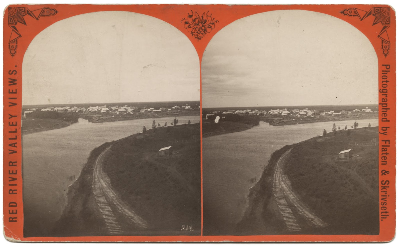
AT Hallock the P. W. runs onto the Jefferson Highway marks and continues with them the rest of the way, going through Northcote, Humboldt, St. Vincent and Noyes to the International Boundary.

The Jefferson Highway touring group paused their sociability run 
in Emerson for "short" speeches and this group photograph...
Pro-lemonaders made another hit when Bronson was reached, where "most excellent lemonade was served" by the ladies. Decorations were mainly American and Canadian flags. Mayors Hodgson and Behrman spoke. The hotel menu at Hallock, a noon control, was a novelty, and uniquely distinctive over any other during the entire trip. Part of it was in French, and embraced dishes served especially in New Orleans. Banners and flags formed the principal decorative feature. Luncheon was served at the hotel and restaurants in the city. The Custom Houses of Noyes and Emerson were soon passed, owing to arrangements having been made beforehand. Short speeches were made by Governor Pleasant and Mayor Hodgson at Emerson.1
We had been sweeping along across the prairie, much of the time with no fences along the road, and came to a turn to the east along what, as memory recalls it, looked like the back side of a farm yard with perhaps an orchard bordered with forest trees in a sort of a scrubby growth. Straight ahead and eighty rods beyond was a dingy railroad station, and just before we reached it a turn to the right and north.

Before us loomed a signboard, high on stilts, announcing the "International Boundary," and there was a moment of bewilderment as we saw in one direction a road turning off to the station and in the other a pair of ruts curving around as entering the farm yard.

The original routing of the Jefferson Highway entered Canada directly from Noyes,
Minnesota into Emerson, Manitoba, Canada.   This is the approximate route the JH
followed. [Source:  Two Lane Traveler] NOTE:  The red line leading off 171 going
north was the 'Emerson Road' (dirt when I was growing up, now plowed under...)  
Over this seeming by-road was the remains of an arch1, placed there last July to welcome the Jefferson Highway tourists on their great sociability run, and the presence of the arch gave rise to the theory that this must be the entrance to the Dominion. Pursuing the tracks a bit further we were convinced that we really were on the highway into the neighboring nation, for at the side of the road was a glorified Keep Off the Grass Sign, bearing a solemn warning against going across the line without proper formalities.

The road took another turn and crossed a railroad track, which itself had crossed another track just previously. The one was the Soo, which ran along the margin of Canada, and the other was the Canadian Pacific, both heading for Winnipeg. All our pictures of an imposing entrance into Canada were dashed, as almost any country cross road is as pretentious. But still there was something picturesque about it and something that impressed itself upon the memory.

There are two railroad stations — one on the American side and one across in Canada, and at each immigration and customs officials, representing the two governments, are on guard. It looked as if it was a pretty simple thing, after all, getting into a foreign country, but it took just about an hour to do it, for a becapped official, swinging down the track to reach the switch tower and climb its dizzy steps to the bird-like house above, said that there was nothing to do but to report to the officials at the Emerson station, which took time and proved not to be the right thing, for we were first to go a mile or such a matter up town and be interviewed by the immigration official and get a card and then go across the street to where the Union Jack flew over the government building, and make our clearance at the customs office.

THE customs officials were polite, but inquisitive. They wanted to know how many in the party, what make of car, how many cylinders, its license number and factory number, whether it was equipped with windshield, top, speedometer and clock, and how much it cost, what baggage we carried and whether we had any camping equipment and how long we expected to tarry in Winnipeg.

Then a very nice old gentleman came down and rummaged through our suit cases in a formal and perfunctory way, withal rather thorough. But first there had come up the serious question as to the very typewriter on which this is being written. It is one of the folding sort and a constant companion. The G. M. would be lost without it, and the work of the organization would be hampered. It was rather important that it, too, make the trip into Winnipeg, for there would be the matter of correspondence and perhaps some magazine stuff.

But the officials were stern about it. They said that the wee machine was dutiable and that we had better put it in hock, so to speak, at the customs office to be picked up on our return, and to borrow a machine in Winnipeg. It looked as if the typewriter was to part company with the official car.

But the missus, waiting all this time down in the auto, said it didn't sound reasonable to her that a car and all that luggage could go in and a mere typewriter barred.

So we went back and argued that the typewriter was a tool of the trade and analogous to a monkey wrench in the tool box.

But these English are a fixed folk. They all had a look at the proposition, and turned it down; it wasn't regular. Then we offered to put up a cash bond, and finally succeeded in parting with $13 to that end, the money being in good American currency. Seeing the brand of money on deposit, a kind gentleman in the office suggested that we would be entitled to that sort back, as it was at a premium in Canada. So, on our return, we got $13.40 in Canadian currency, taking it across to the bank to be exchanged for American money. The rate of exchange had fluctuated during the walk across the street, however, and the bank demanded 50 cents instead of the 40 we had been paid.

And even at that we afterward discovered that we had a few Canadian bills in our script and had to give a discount on them.

BUT our troubles were not over yet. We discovered that our Canadian immigration permit, nor our clearance papers from the customs were sufficient; the becapped gentleman had deceived us. We had to go all the way back to the American side, to that little station of Noyes, to see a blue-eyed Irishman named Fahey in order to get a formidable document showing that Uncle Sam was willing to relinquish us for a few days.

That document had to be turned in to the Canadian customs officials, and then we were ready to go — all excepting the changing of a flat tire that had grown discouraged and depressed during all this formality. If we had known about the rest of that night that tire would have worried us.

But let us move on.

Over a bridge, combined wagon and railroad, under a viaduct we turned and then we were on the road to Winnipeg, sure enough. A little further and we were as good as in France, for, turning into a little village that proved to be Letellier, we grew uncertain of the way and stopped at a house to make inquiries if this were truly the way to Winnipeg.

The answer was "Oui, oui," which the doughboys all will recognize at once.

Turning just at the edge of that little village, which was mostly edge, we were at once in the old Hudson Bay Company's trail, a road 132 feet wide that goes in windings along the Red River of the North right into Winnipeg and becomes Main street, remaining 132 feet wide. That and Portage avenue, at right angles and of the same width, are boasted the widest streets in the world.

The boundary is sixty-eight miles from Winnipeg, and all the tedious details at Emerson, had taken time. It was 5 o'clock when we left Emerson, and that was Canadian time, the Canadians not having turned their watches ahead as the States had.

So we rather stepped forward a little on the gas, for there was a certain strangeness about the country that urged us to get along before dark covered the unknown roads. The trail at places was little more than sections of a fenced pasture, with ruts winding about between an endless row of telephone and telegraph poles. Winnipeg is paving out for miles and someday will have a concrete road to the border, no doubt, but nature still holds sway largely as yet there.

Jefferson Highway Sociability Run, NOLA to Winnipeg
L'Observateur (Reserve, Louisiana) · 28 Jun 1919
And we came into St. Jean Baptiste, a French town of 500 with only two English families in it. We sought to replenish our gas supply and pulled up at a garage and said "Five gallons." The tank filled up as we filled with astonishment. The answer was that we were getting British Imperial gallons, 277.274 cubic inches to the gallon, instead of our own United States gallons of 231 cubic inches. Five of our British cousin's gallons made six of our own, but we paid 40 cents for each and every gallon. 

They said in Winnipeg that American watches can be bought cheaper there than in the states, the protective tariff making it thus, but there was nothing like that about the gasoline, even Imperial gallons. 

Hunger was gnawing and we decided to have a bite to eat, much as we hated to waste daylight. So we asked for the eating place and were directed to a little wooden building that plainly was labeled "Public Hotel." 

Entering we found a dingy office that was a combination of a barber shop and bar. Prohibition had put the bar out of business, age had done for the barber chair, and the prospect was discouraging. But that was where appearances were deceptive, for, after a brief delay, we were led into a neat little dining room and |served with a supper as only the French served food. Bright-eyed French girls were jabbering French in the kitchen, and one of them went to the telephone and assaulted it with a flow of language that was beyond us. 

Then a husky chap went up to the instrument and bawled out a question. "What's the score?" he demanded. It seemed that Cincinnati had won. We felt quite at home for a minute. 

WE had been inquiring anxiously about the road conditions, and the official car had attracted considerable attention, so supper done, we stepped out of the dining room into the midst of a curious crowd that wanted to talk. The men all agreed that the best road lay across the Red River, and they grinned as they said that the largest city along the way was Winnipeg. Afterward we came to realize the point of the remark. Only one village intervened in all that fifty miles. The rest of the trip lay through a country where a house was a surprise and bachelor shanties were the rule. Mile after mile was along a fence-less road that ran at will and at angles, but it was a good road, except lonesome. In the distance we could see straw stacks burning in various places, and occasionally we passed an automobile, but mostly there were solid banks of second growth white birches.

If we had ever needed a bit of gas or some air pressure we'd have had quite a walk for it. And there was that flat spare on the rack!

It sounds a bit dreary, just to tell about it. but it really was a wonderful drive, with the air balmy and the night pleasant. Occasionally we would wonder whether we were on the right road, and would stop at a house to make inquiries. Always we were, although sometimes the children had to be called up to translate, the parents being French.

The engine worked to perfection, the tires held out and we had had a good supper, so on we sped, over bridges, through woods, out in the open. Finally we came to that sole village, passed it, got out into the wilds again and wondered. Then there appeared one of the blessed concrete roads that Winnipeg has built out for nine miles, and we felt as if we were nearing the goal.

But the lights of Winnipeg didn't settle all of our troubles. There was the matter of a hotel. A motorman, waiting to catch his car, offered advice. It wasn't any good, for every hotel he mentioned was full for the night. Finally, after we had tried one after the other, we were forced to put up at one that always will haunt our memories and make as firm in favor of strict hotel inspection laws.

The next morning we found room in a comfortable one...
____________

1 - "A very artistic arch-way had been erected at the border, but we had already been made to feel that we would be just as much at home in Canada as in Louisiana." [The Story of the Run, The Modern Highway, Vol 4, No. 7, August 1919, Pub. by the Jefferson Highway Association]

Wednesday, April 17, 2019

"...baggage, peltry, and squeak..."

A Red River Cart pulled by oxen, at Fort Dufferin
These carts illustrate well the primitive nature and the isolation of the Colony. They are the vehicles in universal use, and are built on the general pattern of our one-horse tip-carts, though they do not tip, and not a scrap of iron enters into them. They are without springs, of course, and rawhide and wooden pins serve to keep together the pieces out of which they are constructed. As they have no tires, and the section of the wheel part or crowd together, according to the moisture, a train of these carts bringing in the products of the hunt is a strange sight. Each cart has its own peculiar creak, hoarse and grating, and waggles its own individual waggle, graceless and shaky, on the uneven ground. To add to its oddity, the shafts are heavy, straight beams, between which is harnessed an ox, the harness of rawhide (shaga-nappi) without buckles.

Everybody makes for himself what he wishes in this undifferentiated Settlement. We return in tatters. Not a tailor, nor anything approaching the description of one, exists here, and a week's search is needed to discover such a being as a shoemaker. A single store in the Hudson's Bay post at each of the two forts, twenty miles apart, supplies the goods of the outside world, and the purchaser must furnish the receptacle for carriage. For small goods this invariably consists, as far as we can see, of a red bandanna handkerchief, so that purchases have to be small and frequent; not all of one sort, however, for the native can readily tie up his tea in one corner, his sugar and buttons in two others, and still have one left for normal uses. How many handkerchiefs a day are put to use may be judged from the fact that the average sale of tea at Upper Fort Garry is four large boxes daily--all, be it remembered, brought by ship to Hudson Bay, and thence by batteaux and portage to the Red River.
Behind them follow not only half a dozen carts, with a most promiscuous assortment of baggage, peltry, and squeak, but also a stray ox and a pony or two...
The caravan by which we and a number of others were carried back to civilization was a stylish enough turnout for Red River. It was supplied by McKinney, the host of the Royal Hotel of the village of Winnipeg. Three large emigrant wagons, with canvas coverings of the most approved pattern, but of very different hues, drawn each by a yoke of oxen, convey the patrons of the party, with the exception of a miner, who rides his horse. The astronomers take the lead under a brown canvas; a theological student for Toronto University, a gentleman for St. Paul, and others follow under a black canvas full of holes; and the third wagon with a cover of spotless purity, conveys the ladies of the party and a clergyman. Behind them follow not only half a dozen carts, with a most promiscuous assortment of baggage, peltry, and squeak, but also a stray ox and a pony or two; a number of armed horsemen, and for the first day a cavalcade of friends giving a Scotch convoy to those who were departing. The astronomers at length reached St. Paul, when they declare their connection with the world again complete, after an absence of about three months, during which they had traveled thirty-five hundred miles.

- From The Winnipeg Country: Or, Roughing it with an Eclipse Party (1886).

THE RED RIVER VOYAGEUR 
by John G. Whittier 
Out and in the river is winding
The banks of its long red chain,
Through belts of dusky pine land
And gusty leagues of plain. 
Only at times a smoky wreath
With the drifting cloud-rack joins--
The smoke of the hunting lodges
Of the wild Assiniboines. 
Drearily blows the north wind,
From the land of ice and snow;
The eyes that look are uneasy,
And heavy the hands that row. 
And with one foot on the water,
And one upon the shore,
The Angel's shadow gives warning--
That day shall be no more. 
Is it the clang of wild geese?
Is it the Indians' yell,
That lends to the voice of the North wind
The tones of a far-off bell? 
The Voyageur smiles as he listens
To the sound that grows apace;
Well he knows the vesper ringing
Of the bells of St. Boniface. 
The bells of the Roman Mission
That call from their turrets twain;
To the boatmen on the river,
To the hunter on the plain. 
Even so on our mortal journey
The bitter north winds blow;
And thus upon Life's Red River
Our hearts, as oarsmen, row. 
Happy is he who heareth
The signal of his release
In the bells of the Holy City--
The chimes of Eternal peace.

Sunday, January 20, 2019

In the News: Winchester House (Geroux Hotel)


THE PRIDE OF OLD PEMBINA. 
The Most Elegant Hostelry in Dakota, North of the Columbia at Fargo.
Special to the Globe. 
PEMBINA, N. D., April 21. – One of the most superb and popular hotels in North Dakota is the Winchester House, of Pembina. It is prominently located in the heart of the city, at the corner of Cavalier and Roulette streets, and has a frontage of fifty feet on Cavalier street and sixty feet on Roulette street. It is built with white Crookston brick, and is three stories high. It is at present one of the most elegant and substantial hotel structures north of Fargo, North Dakota. Supplied and equipped with all the modern hotel improvements of metropolitan cities, it is highly prized by all our citizens and the traveling public. Built in the year 1882, at a cost of about twenty thousand dollars, it is a most fortunate investment for its present owner and proprietor. 
J. W. Winchester, after whom the house is named, is the owner and present proprietor of this most popular public resort. The management of this hotel has been given the personal care and attention of J. W. Winchester and his bright and popular wife. Mrs. Winchester has ever been distinguished as one of the most popular and entertaining of hotel matrons, and her popular parlor entertainments have always been most highly appreciated by all the patrons of this hotel and many invited friends, and to her own careful labor in the culinary department in preparation of meals this hotel owes much for its well-earned popularity for its table luxuries. So acceptable are the meals served in this house that the southbound Northern Pacific vestibule train often stops at Pembina sufficiently long enough to enable passengers to obtain their meals here in preference to those furnished by the dining car attached to these trains. This whole structure is occupied as a hotel, and the house can, with adjoining hotel accommodations, accommodate several hundred guests at a time in a most comfortable and acceptable manner.  
This hotel has been for years the “head center” of the political, social and festive activity of the northeast corner of Dakota. In and about this charming resort are clustered some of the most interesting memories of the past political history of this section. Here it was, in this hotel, that the late Jerry Tuohy, one of the most gifted Democratic leaders of his party, planned some of his most successful political conquests in this district, and here it is where, today, the present Republican leader, Jud LaMoure, sways his numerous political cohorts, and plans his most important political battles. Here, too, Jud often “flushes” with great success and raises the “downs” with less than a pair of “breakers.” This hotel is patronized by the very best class of boarders and travelers and for neatness and comfort this house enjoys a most envious reputation. Many of the county officers are remembered among its guests, and as a hotel bonanza for its owner is the Merchants’ hotel of Pembina and this entire section of the Red River Valley. 
Source:
The Saint Paul Daily Globe
Monday Morning, April 22, 1889
Volume XI, Number 112, Page 6
 __________________

From: Pembina and Turtle Mountain Ojibway (Chippewa) history: from the personal collections and writings of Charlie White Weasel


So as you can see, Charlie White Weasel's testimony concerning who built the Winchester House (originally the Geroux Hotel) and first ran it, confirms what Chuck Walker wrote in SHERIFF CHARLEY BROWN.

Also from the same source:
Lucien Geroux ... was then keeping a hotel in South Pembina, the same building, (improved) now being the one in which the county poor are being boarded and cared for, usually called our poor house. 

The large, 2-storey building just east of the Pembina Bridge, sitting in the area where the future Selkirk Park will be, is what I think is the building mentioned above (i.e., Lucien Geroux's first hotel, later repurposed and used as the Pembina Poor House...)

Sunday, January 13, 2019

Tales from Pembina: Starvation

The 1826 flood, the worst flood of the Red River of the North ever known in modern times...


But before that, deprivation...

In the month of January, it was rumored at the Selkirk settlement, that the hunters who were on the plains of Minnesota in quest of buffalo were starving. The sufferers were from one hundred and fifty to two hundred miles from Pembina, and the only way to carry provisions to them was by dog sleds. The sympathy for their welfare was very great; and even the widow contributed a mite to their relief.

It appears from a statement made by one who was in the colony at the time, that in the (prior) month of December, 1825, a snow storm raged with violence for several days, and drove the buffalo out of the hunter's reach. As this was an unexpected contingency, they had no meat as a substitute, and famine stared them in the face.

Says an eye-witness1:
"Families here, and families there, despairing of life, huddled themselves together for warmth, and in too many cases, their shelter proved their grave. At first the heat of their bodies melted the snow; they became wet, and being without food or fuel, the cold soon penetrated, and in several instances froze the whole body into solid ice. Some again were in a state of actual delirium, while others were picked up frozen to death; one woman was found with an infant on her back within a quarter mile of Pembina. This poor creature must have traveled at the least, one hundred and twenty-five miles in three days and nights. Those that were found alive, had devoured their horses, their dogs, raw-hides, leather, and their very shoes. So great were their sufferings, that some died on the road to the colony after being relieved at Pembina. One man with his wife and three children were dug out of the snow where they had been buried for five days and nights without food, fire, or light of the sun, and the wife and two of the children recovered."
When the spring came, the melting of the winter's snow produced a still greater calamity. On the second day of May, in twenty-four hours, the Red River rose nine feet; and by the fifth, the plains were submerged. A panic now seized every living thing; dogs howled, cattle lowed, children cried, mothers wept and wrung their hands, and fathers called out to their families to escape to the hills. The water continued to rise until the twenty-first, and houses and barns floated in the rushing waters. On one night a house in flames moved over the waters amid logs and uprooted trees, household furniture, and drowning cattle, reminding one of the day when "the heavens being on fire, shall be dissolved."

- From: The History of Minnesota: From the Earliest French Explorations to the Present Time, by Edward Duffield Neill, Secretary of the Minnesota Historical Society (1858))

1 - Alexander Ross