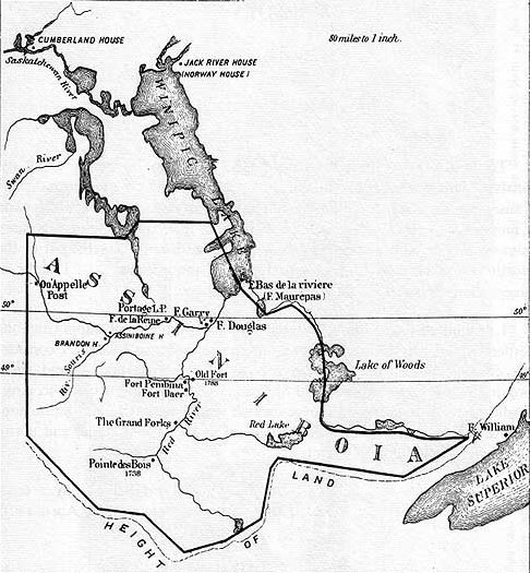
 Shown at left is the Selkirk Settlement circa 1811, the year the land was granted to Lord Selkirk.
At that time, there was no established international boundary between what would become the United States, and Canada. In fact, what would later become the province of Manitoba, and the states of North Dakota and Minnesota, as well as the cities of Winnipeg, Grand Forks, and the towns of Pembina and St. Vincent - while marked on the map - are all still territories, forts, settlements, and trading posts.
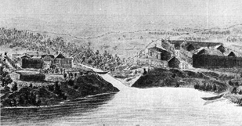 The fur trade companies each had a fort of sorts at the junction of the Red and Pembina rivers, the Hudson's Bay on the east bank of the Red, the Northwesters on the north bank of the Pembina. The above sketch (after Peter Rindisbacher - 1822) shows the Nor'Westers' Pembina Post (r) and Fort Daer (l) where the second party of settlers stayed during the winter of 1812-13. - Manitoba Historical Society
No comments:
Post a Comment